

Watkin Path
It starts nearer sea level than any other route on the mountain, so the ascent is close to the full height of Yr Wyddfa in one go and the overall gradient is the steepest of the six main paths. Old tramways from the copper workings, waterfalls and pools line the lower valley before the ground turns to scree near the top. Gladstone opened it formally in 1892.
- Difficulty
- The most demanding of the six main routes: about 3.7 miles with 860 metres of climb, starting from the lowest trailhead. Graded demanding mountain hiking, with scree-scrambling near the summit.
- Starting Point
- Pont Bethania Bridge Car Park, Nant Gwynant, off the A498 (LL55 4NL)
- Welsh Name
- Llwybr Watkin
- Surface Type
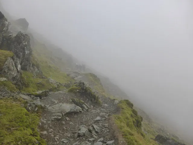
- Loose scree on the upper section below the summit ridge.
- Hazards & Notes
- Path visibility is only intermediate. On the descent, losing the path and drifting left leads to a cliff edge and has caused fatalities; the same ground is straightforward in ascent.
Category: Hiking & Trails
Tags: steepest, scree, historic, quiet-start
Coordinates: 53.0668567, -4.0751894
Part of The named paths to the summit of Yr Wyddfa
More in The named paths to the summit of Yr Wyddfa
Related collections
- Australia's long-distance walking tracks — Australia · 9 locations
- National Scenic Trails of the United States — United States · 5 locations
- New Zealand's Great Walks — New Zealand · 5 locations
- Scotland's Great Trails — Scotland · 14 locations
- The National Trails of England and Wales — England and Wales · 16 locations
- Table Mountain's named hiking routes to the summit — Cape Town, South Africa · 6 locations